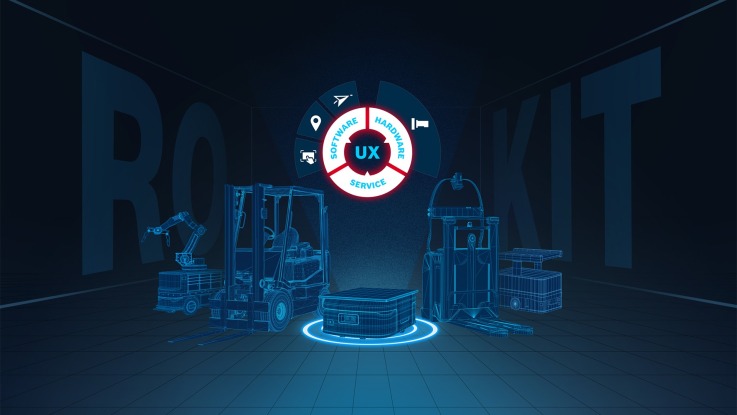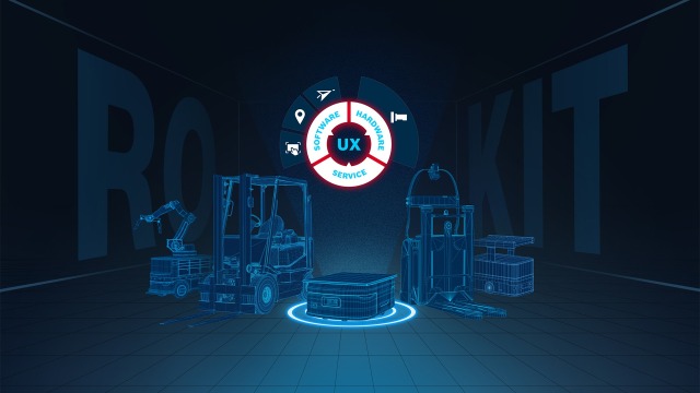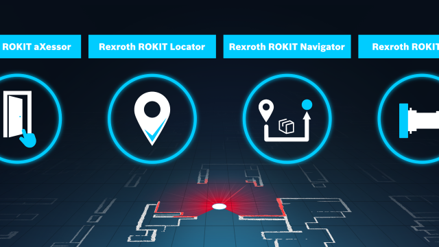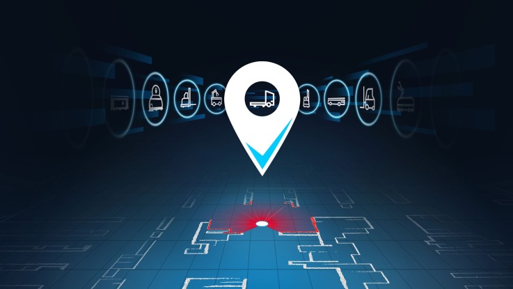
The image shows a white stylized pin with a hook in the tip and a hole in the pin head. Horizontally, various models of automated guided vehicles and manual forklifts can be seen. In the hole of the pin is an Automated Guided Vehicle (AGV).

Level Up Your Mobile Robots.

Rexroth ROKIT Locator – your flexible localization software for mobile robots

Contact us
The image shows a white stylized pin with a hook in the tip and a hole in the pin head. Horizontally, various models of automated guided vehicles and manual forklifts can be seen. In the hole of the pin is an Automated Guided Vehicle (AGV).

Request a test license

We offer you the opportunity to test the Rexroth ROKIT Locator for your application in the field and provide you with support. Please use the contact form to let us know your request.
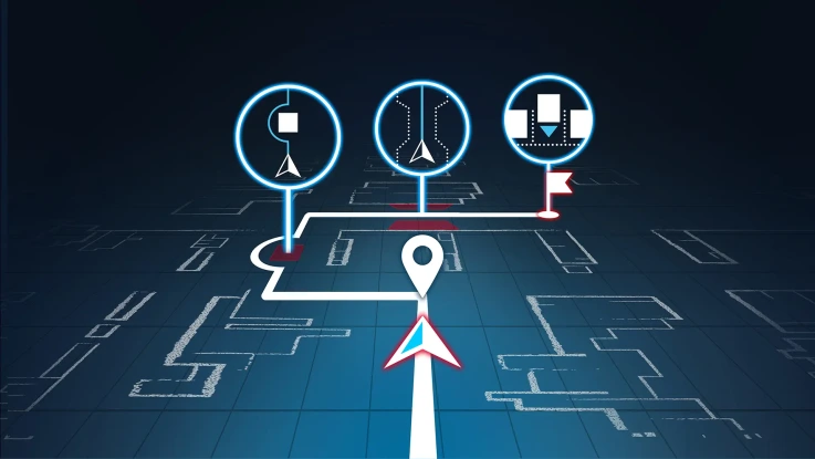
Contact us

Precise real-time localization for mobile robots

You are looking for software for real-time localization of mobile transport robots that can be easily and quickly integrated into your systems? With the laser-based localization software ROKIT Locator from Bosch Rexroth, the search is over. Thanks to the flexible integration options, easy commissioning and intuitive use of the localization software, you can reduce your development and application efforts as well as the service needs of your end customers with the ROKIT Locator. This not only shortens your time-to-market, but also allows you to focus fully on your differentiating features. In addition to the software-only solution, we also offer you the ROKIT Locator.Box, where the software is pre-installed on a compact industrial computer and ready for immediate use.

Laser-based localization and mapping software

The Rexroth ROKIT Locator is a laser-based software for simultaneous localization of your mobile robots and mapping of dynamic environments (SLAM). The powerful algorithm uses the information from up to two laser scanners installed on the vehicle to reliably capture and map the natural environment (natural navigation). In addition, the real-time location system (RTLS) detects changes in the environment while driving, automatically updates the digital map of the surroundings and then makes it available to the entire ROKIT Locator fleet (automatic map update). Localization is reliable, robust and accurate to within a centimeter – without the use of reflectors or markers. In special situations such as open spaces, additional sensor data such as wheel rotation (wheel odometry fusion) can be optionally taken into account.

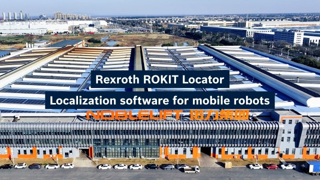
The image shows the factory premises of a Chinese customer. Two dark blue overlays with the texts "Rexroth ROKIT Locator" and "Use Case "Mobile Robots"" are placed in the center.

Features and benefits of the localization software

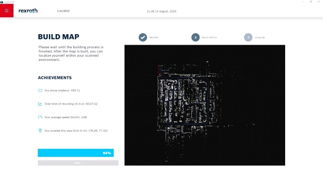
The graphical user interface aXessor shows the completion of a digital map of the surrounding area, including the time required, kilometers driven and average driving speed.

Express mapping

No infrastructure adjustments or expert knowledge required – map your environment with just one click.

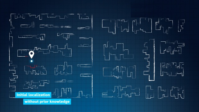
Blue grid map with white structures depicting a warehouse. At one point there is a locating pin and a glowing dot. The structure around it is colored red. It says underneath: Initial localization without prior knowledge.

Initial localization

Our ROKIT Locator is able to locate itself automatically after a change of position.

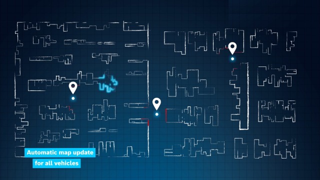
White structures depicting a warehouse environment are shown on a blue grid background. Three locating pins are distributed between the structures, each hovering over a glowing dot. The structures around the dot are colored red. At one point, the structures change color and therefore glow light blue. It says underneath: Automatic map update for all vehicles.

Automatic map update

The real-time location system automatically detects changes in the environment, continuously updates the digital map and shares it with the entire ROKIT Locator fleet.

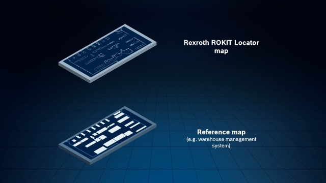
A blue grid map shows two superimposed coordinate systems and reference points.

Reference Alignment

The ROKIT Locator Map can be easily aligned with your existing coordinate system.

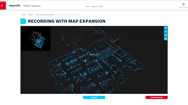
The graphical user interface aXessor shows a black rectangle on which structures of a warehouse can be seen. The rear structures are white, the front ones are light blue. This area is described as Zone_1. You can see a blue trajectory that runs through the structures. This trajectory ends in an arrowhead.

Map expansion

Our real-time location system allows users to extend existing ROKIT Locator maps and replace map zones.

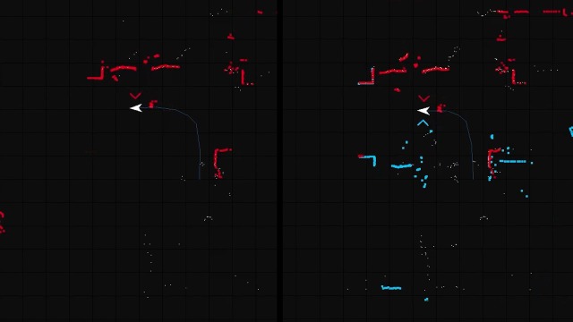
A split screen shows two black backgrounds with grid lines. Each shows an identical trajectory and an arrowhead. While only a few red structures are visible on the left, both blue and red structures are visible on the right.

Dual laser

Depending on the application and need, the ROKIT Locator can support up to two lasers. This enhances the robustness of your AGV.

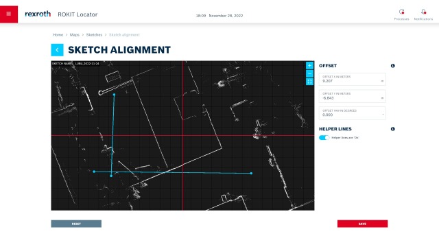
A white graphical user interface shows a black map of the surroundings with grid lines. White storage structures can be seen. Above this is a red axis cross. The coordinates for the X and Y axes are shown to the right.

Manual map alignment

Adjust your digital warehouse map with offsets and rotations according to your individual needs.

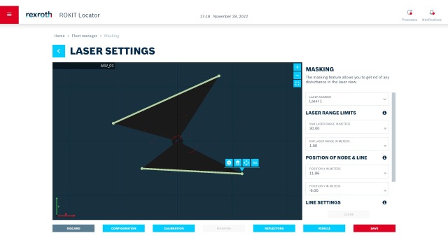
A dark blue rectangle with a grid and two black triangles can be seen on a white graphic surface. Various details about the laser are shown next to it.

Masking

The ROKIT Locator makes it possible to hide vehicle contours in the sensor data.

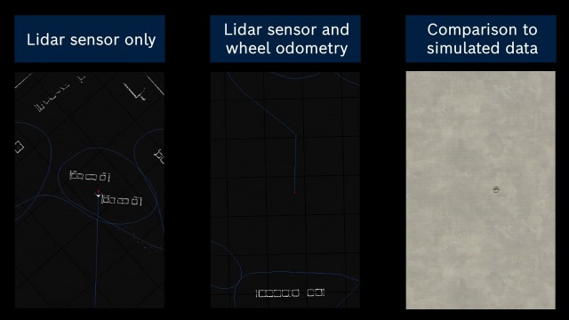
Storage environments can be seen in a three-part image. Some white structures can be seen on the left. "lidar sensor only" is written above them. In the middle, only a few structures can be seen, with "lidar sensor and wheel odoemtry" above them and a gray background with an AGV on the right. Above this it says "comparison to simulated data".

Wheel odometry fusion

In special situations, such as on open spaces, additional sensor sources can be integrated as an option. The recorded laser data can then be merged with the estimated vehicle movement from the wheel rotations, for example.

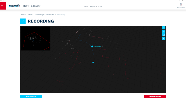
A rectangular black background with grid lines can be seen on a white graphical user interface. On it are red and white structures of a storage environment. In the center is a blue arrow from which a trajectory runs upwards. Halfway up is a marker labeled Landmark_1.

Visual recording

Visual recording supports the commissioning of complex use cases through live mapping.

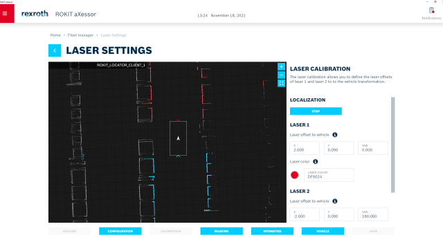
A black rectangle with grid lines can be seen on a white graphic surface. On top of this are white structures, some of which are colored red or blue. In the center is an arrow in a box. To the right of this is "Laser Calibration". Below this is an input mask.

Auto-calibration

Auto-calibration for even easier commissioning: With this function, the existing sensors can automatically be calibrated to each other.

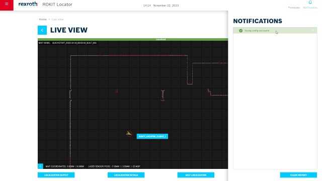
A black square with grid lines and white and red structures as well as a green arrow can be seen on a white graphical user interface. Messages are displayed to the right.

Real-time diagnostic information

Real-time diagnostic information is visualized for you. In addition, we have extended the feature Event Center notifications to include the ROKIT Locator diagnostic messages.

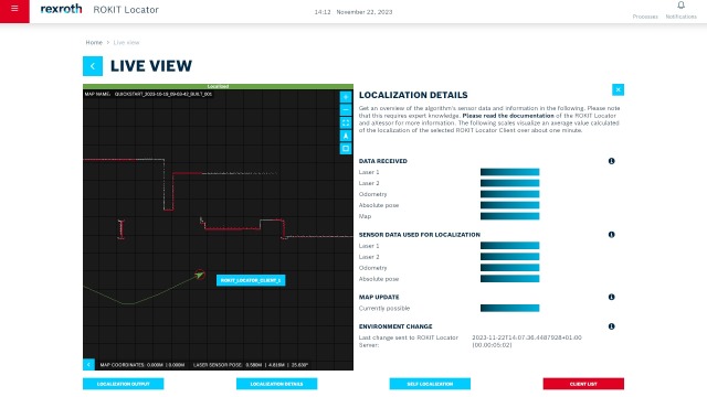
A black square with grid lines and white and red structures is displayed on a white graphical user interface. A green arrow with a trajectory shows the ROKIT_Locator_Client_1. The localization details such as sensor data or map updates are listed to the right.

Extended localization details

Within the live view of our GUI, you get a visual overview of extended localization data and information of the ROKIT Locator algorithm for a better understanding of the parameters.

Blue background with four boxes, three of which are white and one blue. The picture is based on the theme of modularity.

Maximum flexibility for your vehicle fleet

Use the ROKIT Locator according to your needs. It can be used in a variety of vehicle types such as automated guided vehicles (AGVs) and autonomous mobile robots (AMRs) as well as in a wide range of industries and application areas, such as logistics or production. As the software is hardware-independent, it supports numerous laser scanner types and positions as well as various industrial computers. The ROKIT Locator is released for Linux systems and is delivered via Docker.

Blue background with a white stopwatch and an arrow in front of the stopwatch pointing upwards to the right.

More efficiency thanks to seamless integration

The ROKIT Locator integrates seamlessly into your existing systems. No infrastructure adjustments are required for accurate and robust real-time localization. Initial localization and mapping can be done in no time and without any expert knowledge. The ROKIT Locator updates the digital map for you. It automatically detects changes in the environment and updates the map for the entire ROKIT Locator fleet. Support is provided by the intuitive graphical user interface (GUI) aXessor.

Blue background with a light blue hand icon that clicks on a white box.

High degree of usability

The user interface aXessor provides central access to the ROKIT Locator. It ensures quick and easy commissioning of the localization software and enables simple, efficient fleet administration. Diagnostic and localization information is visualized for you in real time. With just a few clicks, you can map your environment and expand or replace your maps. The ROKIT Locator Map can be easily aligned with your existing coordinate system.

Release News: Always up to date

The ROKIT Locator is constantly being developed for you with the help of your feedback. Here you will find an overview of the progress and new functions of our localization software and the graphical user interface aXessor.

On a dark background with an axial grid line, there are dots connected by a luminous line.
  • On a dark background with an axial gridline there are dots connected by a glowing line.

    Rexroth ROKIT Locator

    Release 1.0

  • On a dark background with an axial gridline there are dots connected by a glowing line.

    Rexroth ROKIT Locator

    Release 1.1

  • On a dark background with an axial gridline there are dots connected by a glowing line.

    Rexroth ROKIT Locator

    Release 1.2

  • On a dark background with an axial gridline there are dots connected by a glowing line.

    Rexroth ROKIT Locator

    Release 1.3

  • On a dark background with an axial gridline there are dots connected by a glowing line.

    Rexroth ROKIT Locator

    Release 1.4

  • On a dark background with an axial gridline there are dots connected by a glowing line.

    Rexroth ROKIT Locator

    Release 1.5 with aXessor 1.2

  • On a dark background with an axial gridline there are dots connected by a glowing line.

    Rexroth ROKIT Locator

    Release 1.6 with aXessor 1.3

  • On a dark background with an axial gridline there are dots connected by a glowing line.

    Rexroth ROKIT Locator

    Release 1.8 with aXessor 1.8

On a dark background with an axial gridline there are dots connected by a glowing line.

Rexroth ROKIT Locator

Release 1.0

  • First product version of our award winning laser localization software. Comes with easy integration, an outstanding mapping process and a highly reliable localization.

On a dark background with an axial gridline there are dots connected by a glowing line.

Rexroth ROKIT Locator

Release 1.1

  • With our new feature Reference Alignment you can now transform the ROKIT Locator map with respect to a given (coordinate) system and easily localize yourself within your desired application (e. g. a warehouse management system).
  • We enhanced our product in many aspects: from improved security, more supported laser scanners up to additional licensing choices (e. g. dongles).

On a dark background with an axial gridline there are dots connected by a glowing line.

Rexroth ROKIT Locator

Release 1.2

  • New feature: fusion of external wheel odometry for higher robustness in dynamic areas and to handle large, empty areas
  • New feature: provide the full covariance matrix of the localization uncertainty for easy interpretation or fusion in downstream applications
  • Enhanced the precision of the feature Reference Alignment

On a dark background with an axial gridline there are dots connected by a glowing line.

Rexroth ROKIT Locator

Release 1.3

  • New feature Map Expansion: Use our graphically guided mapping algorithm for extending existing maps – without expert knowledge or interrupting operations. Whether a new corridor, a new hall or a new outdoor area – there are no limits.
  • Obtain the necessary Dongle CmStick/C Basic together with the ROKIT Locator in one order from Bosch Rexroth or via direct sales from WIBU Systems AG.

On a dark background with an axial gridline there are dots connected by a glowing line.

Rexroth ROKIT Locator

Release 1.4

  • New feature Dual Laser: Enabling the use of two laser scanners for improved robustness in challenging use cases
  • Enhanced localization for small vehicles in narrow, highly repetitive environments

On a dark background with an axial gridline there are dots connected by a glowing line.

Rexroth ROKIT Locator

Release 1.5 with aXessor 1.2

  • New beta feature Reflector Integration enables to
    • increase the robustness in defined areas with reflector stripes
    • deploy the ROKIT Locator without structural changes in areas that are often a problem for laser localization technologies
    • realize further fields of application and use cases for the ROKIT Locator

  • Further development of the graphical user interface:
    • Reflectors can be visualized within the point cloud and their parameters can be set.
    • Now also available in Chinese
    • An extension of the Event Center allows faster and clearer access to the processes of the ROKIT components.

On a dark background with an axial gridline there are dots connected by a glowing line.

Rexroth ROKIT Locator

Release 1.6 with aXessor 1.3

  • Auto-calibration for easier commissioning: With this function, the existing sensors can automatically be calibrated to each other.
  • Real-time diagnostic information is visualized for you. . In addition, we have extended the feature Event Center notifications to include the ROKIT Locator diagnostic messages.
  • Improvement of the wheel odometry fusion provides more robustness in mapping areas where the environment offers few attributes for localization.
  • Extended localization details: Within the live view of our GUI, you get a visual overview of extended localization data and information of the ROKIT Locator algorithm for a better understanding of the parameters.

On a dark background with an axial gridline there are dots connected by a glowing line.

Rexroth ROKIT Locator

Release 1.8 with aXessor 1.8

  • Setting of static map zones possible
  • Even more robust localization through a new interface that allows absolute poses of an external sensor, such as a QR code camera, to be integrated into the ROKIT Locator software
  • New module for better monitoring of the entire ROKIT Locator fleet
  • Compatibility check and map distribution between fleet and server simplified
  • Adaptation of the versioning of the user interface aXessor to that of ROKIT Locator 1.8

ROKIT Locator.Box – Localization out of the box

Now you have the choice between the pure software solution ROKIT Locator or the ROKIT Locator.Box – ready for use on a compact industrial computer. The ROKIT Locator.Box is designed for convenient and practical integration of our laser localization software into your mobile robots. It consists of a pre-installed and licensed ROKIT Locator software, a fully supported operating system and an industrial-grade, very compact and robust high-performance industrial PC (Pokini F2).

Real-time location tracking for forklifts in action

One Pager

Get a first overview of the ROKIT Locator

Download PDF

Test license

We offer you the opportunity to test the Rexroth ROKIT Locator for your application in the field and provide you with support. Please use the contact form to let us know your request.
Send request
The pictures show two men in conversation. One wears a white shirt and gray pants, the other a dark suit, white shirt and tie. In the background you can see a production plant.

Interested?

We look forward to answering your questions about Rexroth ROKIT as well as the individual ROKIT components.

Feel free to contact us.

ROKIT News

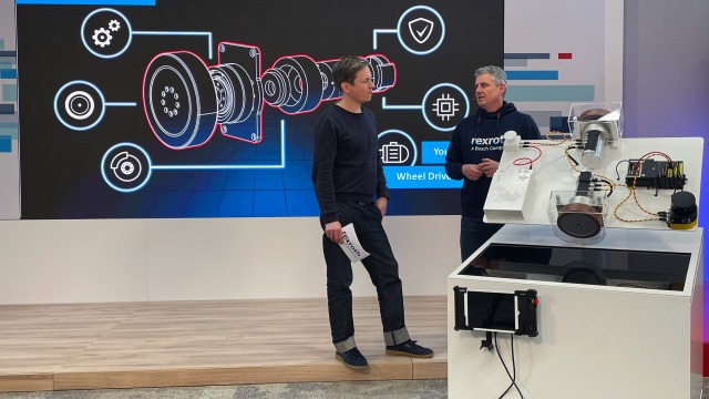
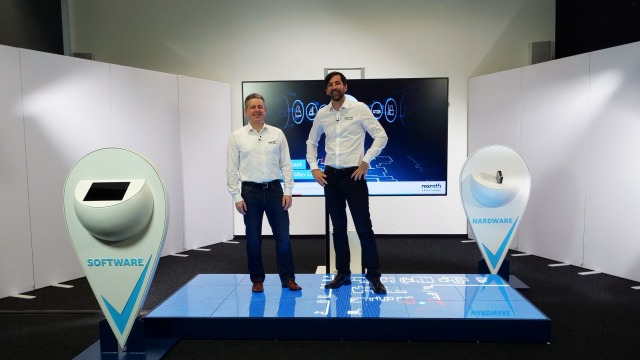
Joerg Heckel (Head of New Business at Bosch Rexroth) and a moderator stand in front of the ROKIT-ctrlX AUTOMATION exhibit and explain the ROKIT motor.

Robotics Webcast – Episode 4

Find out why building mobile robots has never been easier with the innovative robotics and automation kit from ROKIT and ctrlX AUTOMATION.

Robotics webcast – Episode 3

Robotics webcast – Episode 3

Get the latest insights on new features of the ROKIT Locator as well as on the development status of the ROKIT Motor and the ROKIT Navigator.

Robotics Webcast – Episode 2

Robotics Webcast – Episode 2

Get the latest news about our Rexroth ROKIT components

“Call the Expert” Podcast – Episode 2

“Call the Expert” Podcast – Episode 2

Our experts talk about the Chinese intralogistics and robotics market as well as the ROKIT Locator

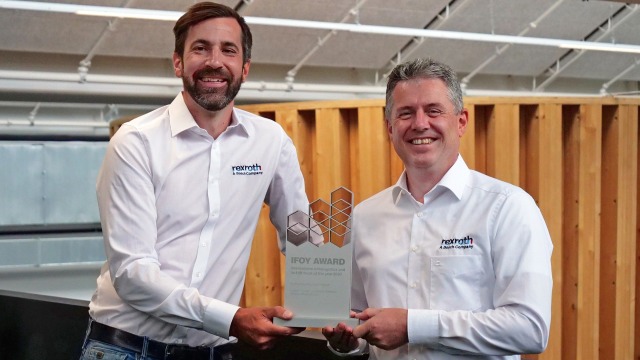
IFOY AWARD for our ROKIT Locator

IFOY AWARD for our ROKIT Locator

Laser localization software awarded in the category “Intralogistics Software”

The title boxes Call the Expert and Podcast are displayed on a grid together with a telephone receiver symbol.

“Call the Expert” Podcast – Episode 1

Our experts exchange about the ROKIT Locator and answer your questions

Jörg Heckel (Project Director Intralogistics Robotics at Bosch Rexroth) and Christopher Parlitz (Head of Development Intralogistics Robotics at grow platform GmbH) talk about the Locator

Robotics Webcast – Episode 1

Our experts talk about the ROKIT Locator

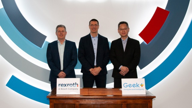
Joerg Heckel (Project Director Intralogistics Robotics at Bosch Rexroth), Thomas Fechner (Senior Vice President Product Area New Business at Bosch Rexroth) and Jackson Zhang (Vice President at Geek+ Europe) sign the cooperation agreement regarding the localization software Locator

Bosch Rexroth and Geek+ Join Forces in Robotics

Global developer of innovative logistics robotics solutions partners with Bosch Rexroth localization software